

Can You ID All These Texas Borderland Areas from a Satellite View?
El Paso, Texas is surrounded by a number of smaller towns and communities. Can you tell, from these satellite images, which is which? (Hint: Each photo tells you.)
El Paso, Texas goes way back. The Spanish got here around 1598 but it really started booming in the 1800's and was officially incorporated in 1873.
Over the years, many neighboring communities have popped up and about 40 miles north ... more or less ... of the 915 sits the second largest city in the entire state of New Mexico.
Thanks to modern technology, we can now see our world as we never have before. From miles and miles above it.
The following pics of El Paso and our neighbors were taken by satellite.
if you're an El Paso "lifer", you may be able to tell which city is which. If not, look closely and the pics will tell you.

That's El Paso.
With a population of nearly 700,000, EP Tx is the 6th largest city in Texas.
Now, let's head north.

That's Las Cruces.
With around 112,000 residents, it's the second largest city in New Mexico. Albuquerque is numero uno.
Next, 2 cities that are in between LC and ELP.

Anthony is split between two states.
Part of it is in Texas while the other part sits in New Mexico.
Finally, two more El Chuco neighbors.
The first is north of El Paso.
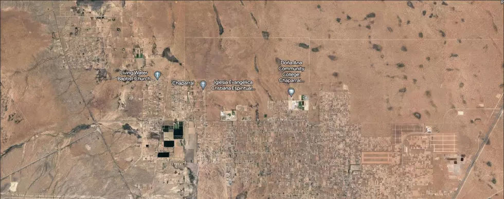
That's Chaparral, New Mexico.
Located just a few miles from the northeast edge of El Paso.
Next, we head about 28 miles east of El Paso.

That's Horizon City, Texas.
To look up other areas in and around Texas ... or, across the globe for that matter ... click here.
Spooky Texas Home For Sale that Used to be a Haunted House
Gallery Credit: Zillow
More From 93.1 KISS FM